Welcome back to the New Zealand overview! It’s been a little while since I’ve written about New Zealand since it took me awhile to get all of the California trip into writing, so thank you for being patient! This week and next week I’ll be covering the Tasman Region. I’ll be breaking it up in to two parts since we did two exciting hikes during our time in this region. We last left off with Jay and I arriving to the South Island by ferry across the Cook Strait.
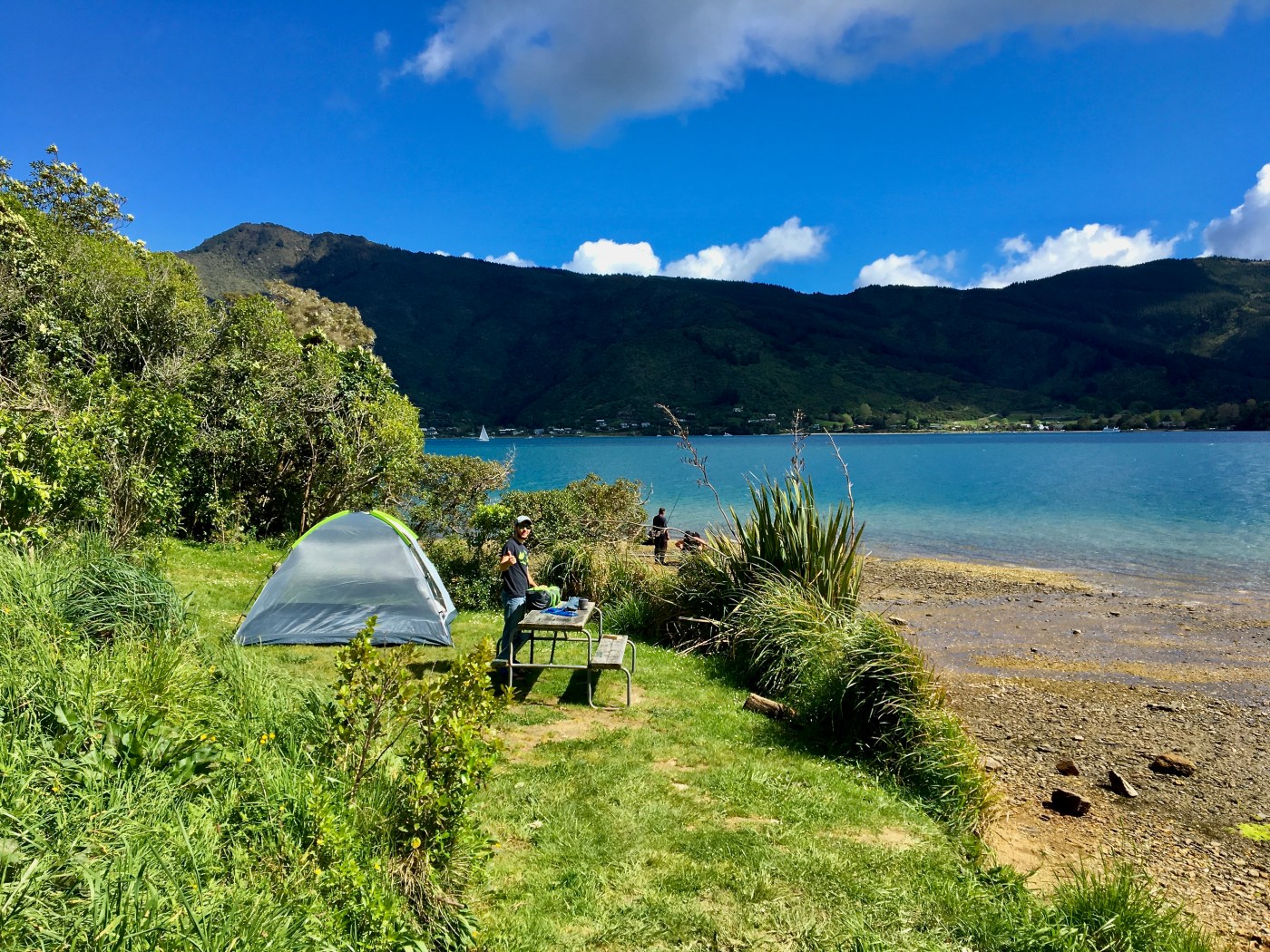
Once we got to shore we headed to a DOC campground called Aussie Bay that was right next to the water in the Aussie Bay. We came to learn that the site was also a very popular fishing spot because family after family set up their fishing gear and spent the afternoon. One family was using an unconventional way of casting their line by using a PVC pipe to make a pressurized system to shoot the line out on the water. Strange sound to hear as you’re making dinner, but being curious we went down and learned what they were doing.

The next morning we packed up and headed to the town of Nelson to pick up dehydrated foods and miscellaneous supplies for our Abel Tasman Great Walk we’d be starting the next morning in the town of Mārahau. While in Nelson we stopped at one of the iSite’s to figure out how we’d return to the town of Mārahau after our hike since we’d only be doing the hike one way. We decided to take the ferry from Totaranui Campground because it was the quickest way to get back to Mārahau and it included some sightseeing of the coast and wildlife. After our stop in Nelson we made our way to Mārahau and checked in to a holiday park called Old MacDonalds Farm Holiday Park for the night. That night we packed our backpacks for the next four nights and 31 miles. The next morning we got going early and hiked the 7.5 miles to Anchorage hut where we’d stay our first night on the Abel Tasman Great Walk.
The hike is relatively flat from Mārahau to the Anchorage Hut and winds its way through trees along a very well groomed and cleared dirt path. At a certain point there is a a small side trail that leads down to the water. Jay was super excited to be so close to the water and this feature of the hike is why he chose it in the first place. Jay grew up going to a lake in the Adirondacks where his family has a camp. During the summer there, sailing is a popular past time, and so he learned to sail and race with family and on his own. Because of this love of sailing, he has a love for anything water- as long as it is above water because he isn’t as much of a water fiend as I am.
We arrived at the hut in the afternoon, and since it was pretty warm out we quickly got our suits on and jumped in to the frigid water. After splashing around for awhile we explored the area. The hut is very close to the water and has a main room with a long wooden table adjoined to a cooking area where people can use their own stoves to cook their meals. Off to the right of this building are the bunk rooms; each with two sets of bunkbeds. On the other side of the bunk rooms is a bathroom area. There are no showers but there is a hose with a spray nozzle down near the beach for rinsing off. Once it got closer to dinner time we made our meal and then sat down to play our game of choice for this trip, gin rummy.
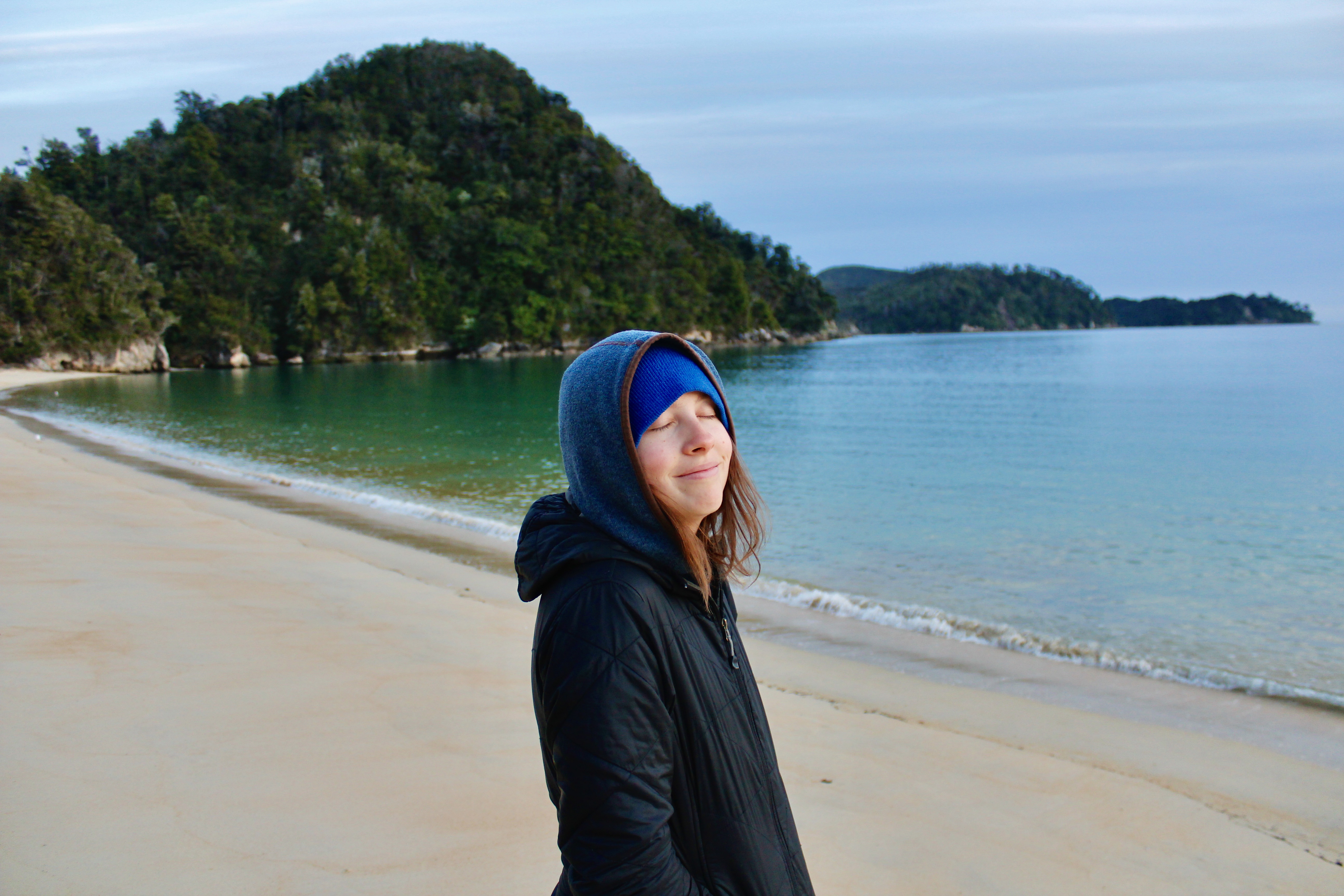
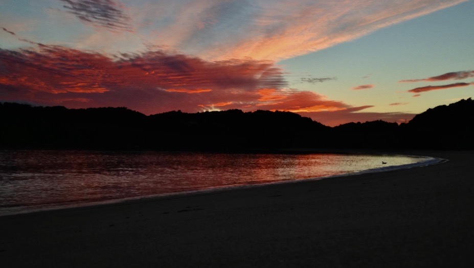
The next morning we woke up at the butt crack of dawn because we were eager to see the sunrise. It gets chilly during the night in the spring so we layered up and made our way out to the beach to wait for the cotton candy skies to emerge. Thankfully there were a few clouds in the sky, so for what felt like a millisecond, we got some pinks, purples and oranges. After attempting to get a few time lapses, and watching Jay run up and down the beach to try to get all the colors in a photo, the sun came up turning the sky in to a light blue and the clouds back to white. Below is one of Jay’s best sunrise shots and my sleepy face from waking up so early. Photo credit belongs to Jonathan Berkun.
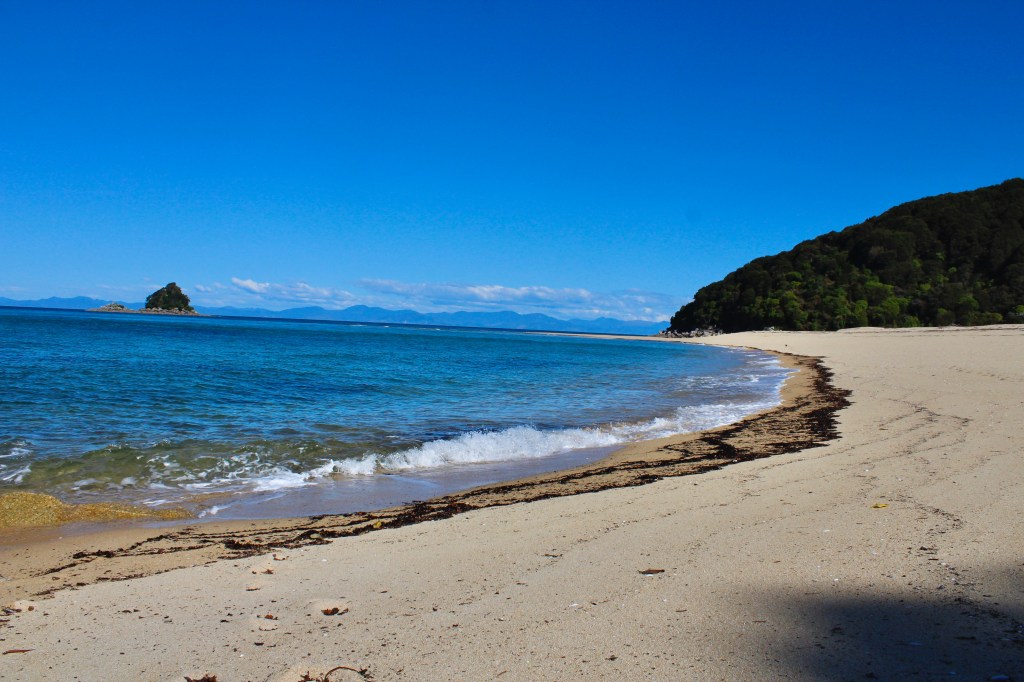
We ate breakfast and got back on the trail. This second day we hiked just over 5 miles, and for this leg of the hike we got to hike across an estuary. We planned the hike based on when the tide would be low so we wouldn’t have to do the longer hike around. We hung out and ate some trail mix for lunch on a beach before heading down the trail to cross the estuary. For the walk across the estuary I brought my Teva’s, but once I started walking through the water pebbles kept getting stuck in my sandals so I ended up just going barefoot. Once we got across the estuary we found some rocks to sit on and put our hiking boots back on. Right as I got my boots back on and started to put my pack back on, I realized a part of my hip belt system was missing.
Earlier in the day as we were about to leave the Anchorage Hut, Jay had noticed a small strange looking item that seemed to be a piece of something. He mentioned that it could be some part to my backpack. I looked at it and shrugged it off saying nah. Of course once across the estuary with my boots back on I realized he was right. If the piece was not that necessary I would’ve just said forget it and kept going, but it seemed to hold a piece of the hip belt to the backpack so I figured there could be complications later. Jay will forever hike much faster than I, and I didn’t want him having to wait as I hike the few miles to Anchorage and back so I told him to just meet me at the Bark Bay campground where we’d be staying our second night. After back tracking and shaking my head at myself the whole way I found the piece and started the hike over again. Several hours later I finally walked in to the Bark Bay campground, backpack intact, dignity somewhat in pieces.
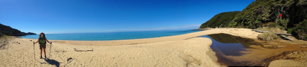
Beach where we ate lunch, Photo Credit: Jonathan Berkun 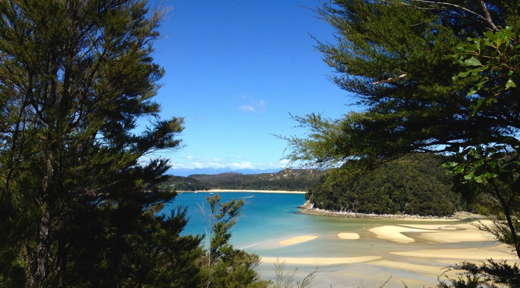
View once across the estuary, Photo Credit: Jonathan Berkun
The bark bay campground was situated right next to the water on a flat grassy plateau. It was very buggy so we hung out by a fire a fellow camper had made and chatted with other hikers. The next leg of our hike was my least favorite. As mentioned during the post that includes our hike up to the Powell Hut on the North Island (read about that adventure here), I am not the best backpacker (or hiker for that matter) while going uphill. I hike a bit faster when only challenged by short mounds of dirt, not tall mounds of dirt. To add to that, this day was our longest.
While 8 miles may not seem terribly long, it is when you’re hot, sticky, carrying a backpack, and me when hiking uphill. Eventually we got to the Awaroa inlet and from there it was only a half mile, so I mustered the strength and then collapsed at the Waiharakeke Bay campsite. That night we had a fire with our fellow campers after foraging through the woods to find firewood and striking out a dozen times while trying to light the fire. It rained that night so we woke to a nice soaked tent that would just have to remain soaked until we arrived at Whariwharangi Hut.
We got hiking once again and this day we had 6.5 miles to cover. Thankfully there wasn’t much uphill on this last leg of our adventure. We hiked close to the beach for most of the 6.5 miles until towards the end where the trail actually was on the beach at Mutton Cove before ducking back in to the woods. Before reaching the hut we stashed our packs behind some large boulders and took a side trail out to Separation Point. When we got there we heard bird calls. As we neared the sound we found fiberglass birds. Apparently conservation efforts were in motion to set up a Gannet colony to restore the ecology of the Abel Tasman park by using audio and fake birds to attract the birds.
We eventually made our way to the hut and found a spot to sleep on the upper level. The room consisted of three sections of beds snugged up next to each other essentially creating 3 large beds. We then made our way down a trail to the beach and explored the area while soaking up some sun without heavy packs on our backs. After dinner we made friends with the others sleeping in the same room as us and played, you guessed it, gin rummy. The next day we packed up our gear and backtracked 4 miles. We hiked back down past the side trail to Separation Point, back out on to Mutton Cove, and then almost all the way back to our previous campsite. Totaranui Campground is right next to the beach where the ferry would be picking us up. We hung out for awhile and then got picked up by the boat along with a few other hikers.
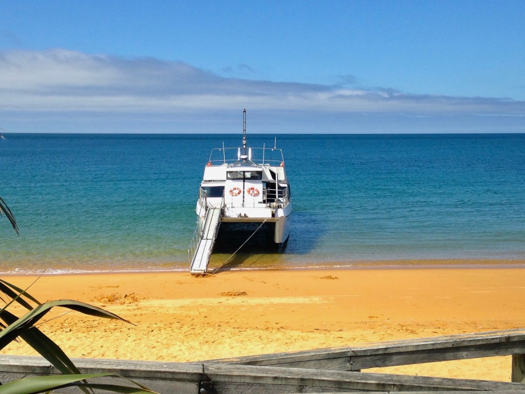
Ferry from Totaranui to Mārahau, Photo Credit: Jonathan Berkun 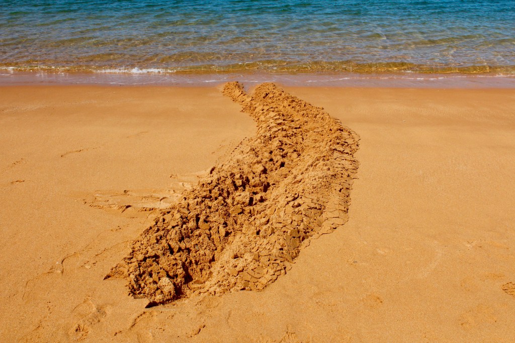
Drag marks from the boat when the tractor pulled us out, Photo Credit: Jonathan Berkun
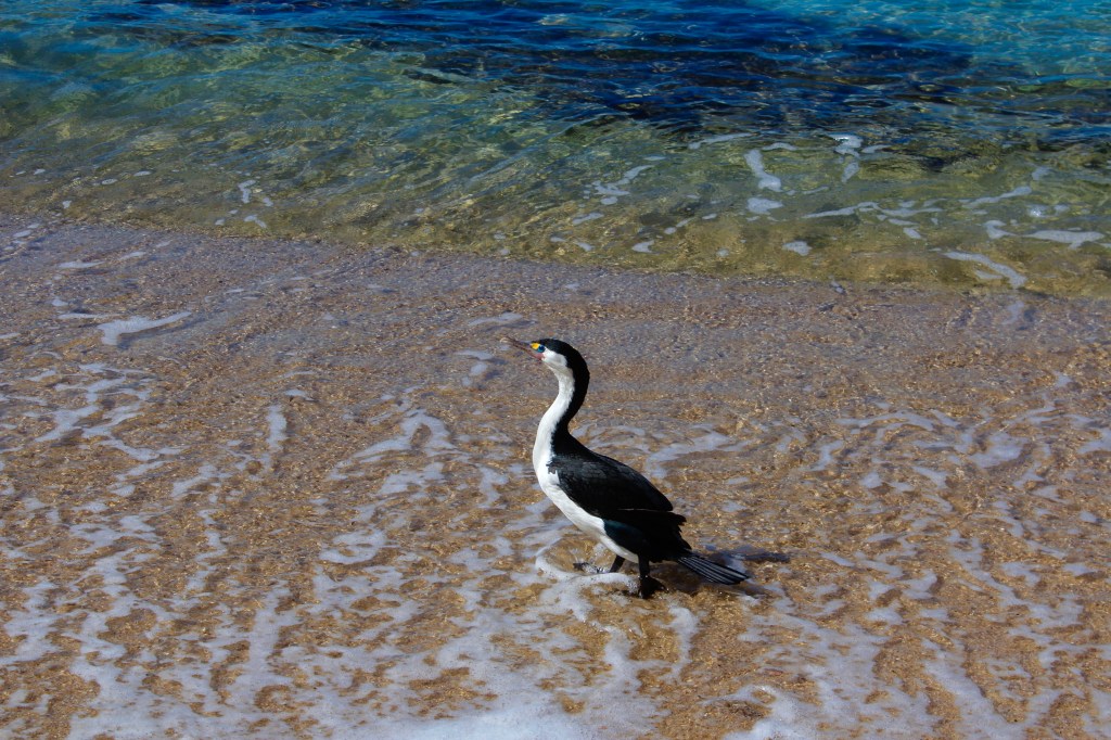
On the ride back to Mārahau we got to see seals (no good photos unfortunately) lounging on the sunbaked rocks along the Abel Tasman coast. When we arrived at the beach back at Mārahau, Jay and I had a new experience. Instead of getting off the boat like we got on, a tractor came to the boat in the water and lifted us up and started driving on the beach. Apparently because of low tide, this is the most efficient way for them to not make passengers have to walk the length of the beach back to the road. Once we arrived at the car we drove back up to Old MacDonalds Farm Holiday Park to check in and pitch the tent. Jay and I were craving comfort food after backpacking and eating only dehydrated meals, so we got two pizza pies from The Park Cafe Mārahau and ate them entirely. The next morning we packed up the tent and we headed off for the next adventure.
Thanks for reading about our hiking adventure along the Abel Tasman Great Walk! Next week we’ll be in the Nelson Lakes area still in the Tasman Region. There we’ll be high above the clouds and sliding down snowy hills like penguins. Question for my readers: what is the longest hike or backpacking trip that you’ve done and where was it? See you next week!
Mahalo and Kia Ora!

Leave a comment