
A big hello to my family, friends, kind strangers, and fellow bloggers! This week’s post is about a week I recently spent in the White Mountains of New Hampshire at The Village of Loon Mountain (VOLM).
After dating for a year- instead of getting a puppy or moving in with each other fully- my parents decided to buy two timeshares. They each had their own home property that they both split their time at, but decided that instead of getting another property they’d get two timeshares for a week each to vacation at during the year. Just like Jay and I, they chose to combine their lives before getting married… just in our case, we bought two cars together instead of two timeshares. Every year we spend the week up at The Village of Loon Mountain exploring the Franconia Notch, Kancamagus Highway, and sometimes even the Crawford Notch- though most of our exploring in the Crawford Notch, Pinkham Notch, and Evans Notch happens when we have our our timeshare week in the spring at Eastern Mountain Slopes Inn in North Conway, NH.
The week began with a friend of mine named Cat- who some of you might remember from a post I did awhile back about a camping trip at Mount Greylock in Western Massachusetts. On Saturday we made our way up to VOLM. As we neared Lincoln, NH the traffic started getting worse and worse. I knew that Columbus Day (It should be changed to Indigenous Peoples Day) weekend was always busy, but figured it wouldn’t be worse than the weekends in the past because of Covid-19…I was wrong. Not once in my years going up to this place has it taken almost 30 minutes to go the quarter or half mile (depending on coming in from the north or south) from the off ramp to White Mountain Bagel Co.- best bagel and sandwich shop in Lincoln! There we met a friend from university (Jen) that came over from North Conway to stay with us for the weekend. After eating lunch we made our way to Loon, checked in, hung out, swam in the clubs pool, and went to bed.
Mt. Osceola East Peak Summit has no view so this is from about .25 miles from the summit, and about 1.25 miles from Mt. Osceola Summit, Photo Credit: Sarah Marsh
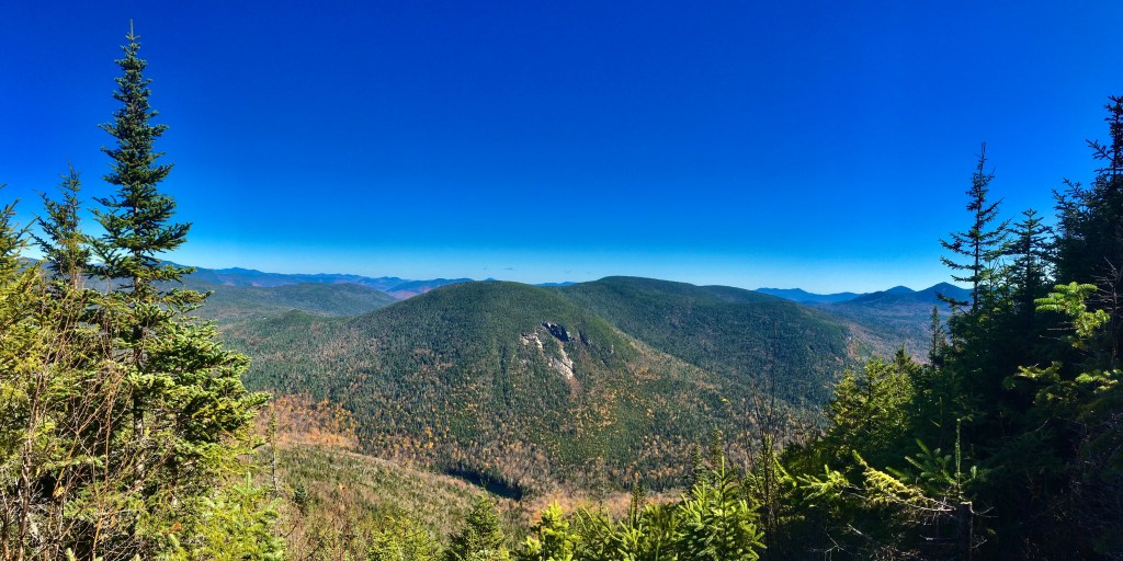
The next day we decided to go for a hike. After doing some research to find a less trafficked but close enough to us hike, we settled on the Greeley Ponds trail head. It took a little while to get to the trail head up the Kanc (Kancamagus highway 112 that connects Lincoln to Conway through the White Mountains) because of all the leaf peepers, but once there we were only 1 of about 5 cars in the parking lot. At first we planned on taking it easy and just hiking up to the Greeley Ponds- about 1.5 miles- but since we were feeling good after the 1.3 miles to the Mt. Osceola trail intersection, and because the summit was only 1.5 miles away, we decided to hike to the East Peak of Mt. Osceola. Little did we know, the hike was super steep and slick. The view was totally worth the sore muscles we had the next morning after the 5.6 mile hike though.
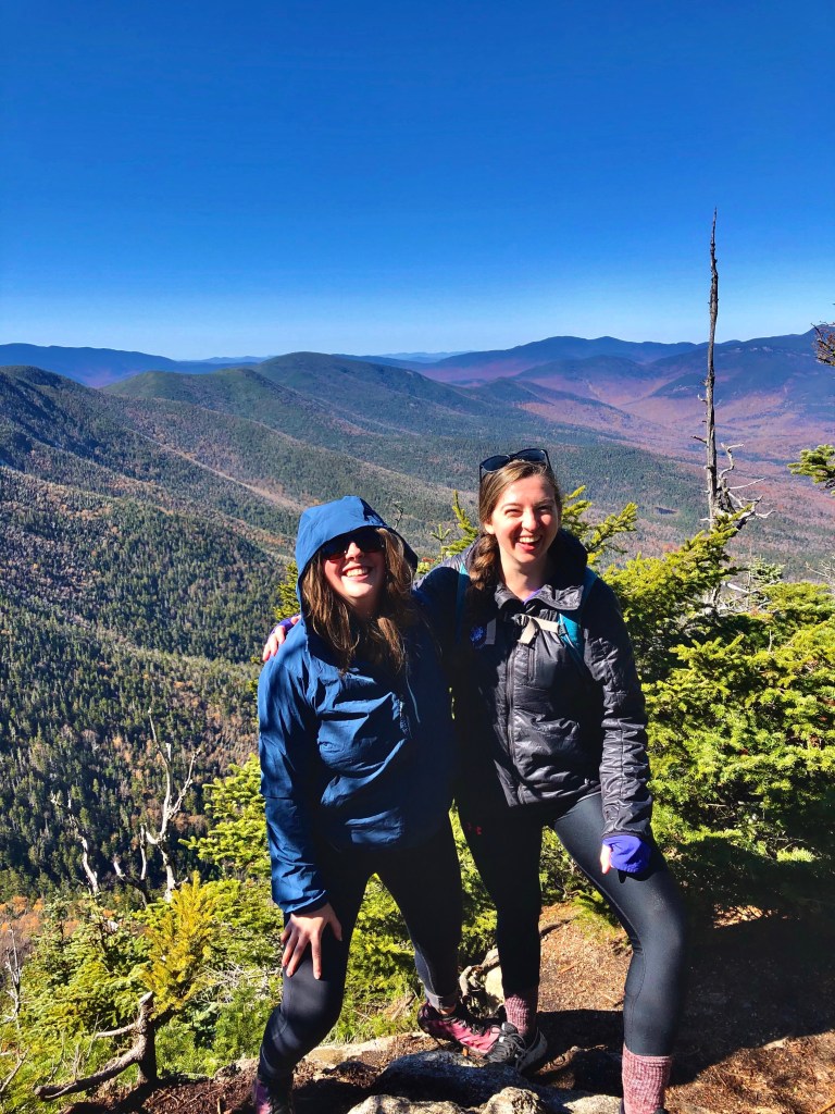
Jen and I at the pseudo summit view, Photo Credit: Cat Costello 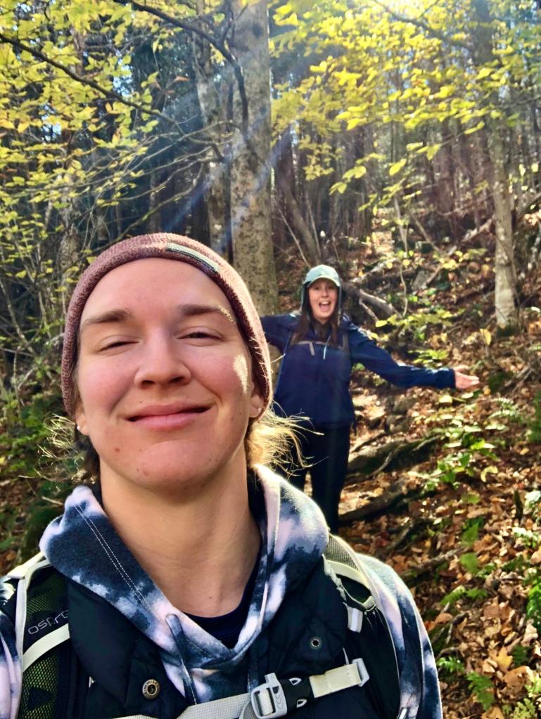
Cat and I on our hike back down,
Selfie Credit: Cat Costello
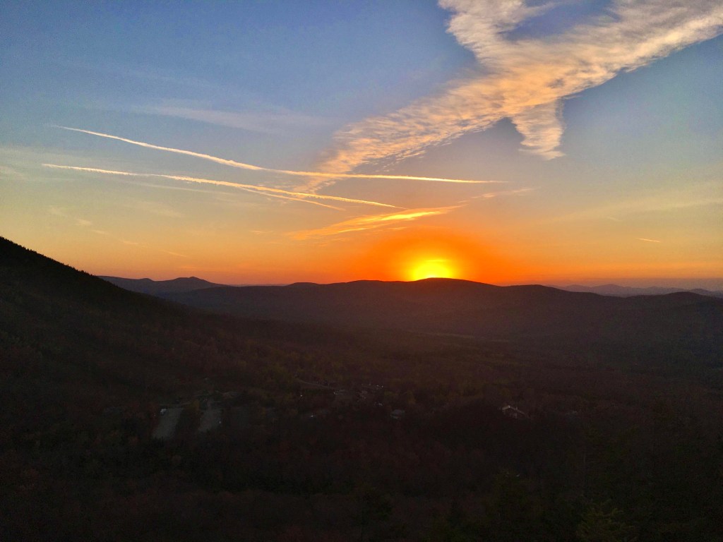
That night we laughed and played cards until we were all too sleepy to keep our heads up. The next morning both of my dear friends got going to their respective homes while I spent the day lounging around. The next morning I randomly woke up at the exact moment a beautiful sunrise was unfurling out my window. Being a sunrise junkie, I got out my phone and attempted to capture the beautiful colors using my phone.

Sunrise at VOLM, Photo Credit: Sarah Marsh
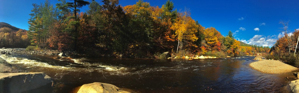
Later in the day my parents arrived, and my mother and I stayed up late watching a movie and bonding with conversation while polishing off almost 2 bottles of wine- most I’ve drank in a LONG time. The following day, with a bit of a hang over, my parents and I in the afternoon went for a walk up the Pemigewasset river and did a bit of sightseeing along the Kanc. We first went down to the river to check the levels and then walked from the Hancock Campground over to the Wilderness trail that then leads to the right over a wire bridge and back over the car bridge on the Kanc and then back to Hancock Campground. It’s a really nice and easy walk that shows you river, bridges, leaves, and mountains.

My parents on the Lincoln Woods Trail Bridge, Photo Credit: Sarah Marsh 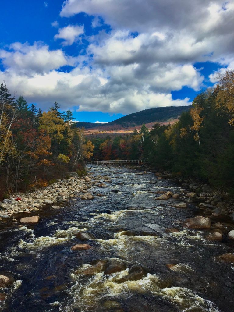
View of the Lincoln Woods Trail Bridge, Photo Credit: Sarah Marsh
After our walk we did a bit of sightseeing higher up on the Kanc looking back on the valley towards Lincoln, NH and then called it a day. The next day we were all feeling more awake and adventurous so we decided to do a longer sightseeing drive up Franconia Notch and down 302 to Base Station Road that leads up to the Cog Railway area and Jefferson Notch Rd. We first stopped to have lunch at a pull off that gives you access to a gorgeous gorge (I hat to!) along the Ammonoosuc River that flows from Mt. Washington to the Connecticut River. A few years back, while Jay and I were visiting my parents during their week at VOLM, my dad, Jay, and I stopped at this gorge while the Twin Mountain Fire Fighters were doing a Swift Water Rescue Course. This year my parents and I happened to pick the exact same day AGAIN that they were running this course and actually got to see them setting up all the gear this year.
Before the Swift Water Rescue Course gear was fully set up, Photo Credit: Sarah Marsh
After finishing lunch and chatting with the head fire fighter setting up the gear for the course- while wearing our masks and keeping our distance- we made our way up the Jefferson Notch Rd. because my mother wanted to hike a bit of one of her favorite trails in the White Mountains: the Caps Ridge Trail. The trail is short but fairly steep and is one of the segments that gets you up to Mt. Jefferson the quickest because you start at already 3000 ft. above sea level. My father and I were very full from lunch and were saving our energy for a loop hike around Bald Mtn. and Artists Bluff over at Echo Lake and Cannon Mtn. later so we decided not to hike very far. Eventually my mother turned around and met us back at the car and we headed on our way back to the Echo Lake and Cannon Mtn. Area, with some sightseeing along the way of course.
Once over at Echo Lake and Cannon Mtn. my father and I split up from my mother, and while we did the loop she checked out Echo Lake and then made her way up Bald Mtn. The hike was only about 1.5 miles but was fairly steep right up to the bluff and up the side trail that goes up to Bald Mtn. Because a storm from the west was rolling into the Whites, the bluff and mountain were being blasted by wind.
Sunset from Bald Mtn. Summit,
Photo Credit: Sarah Marsh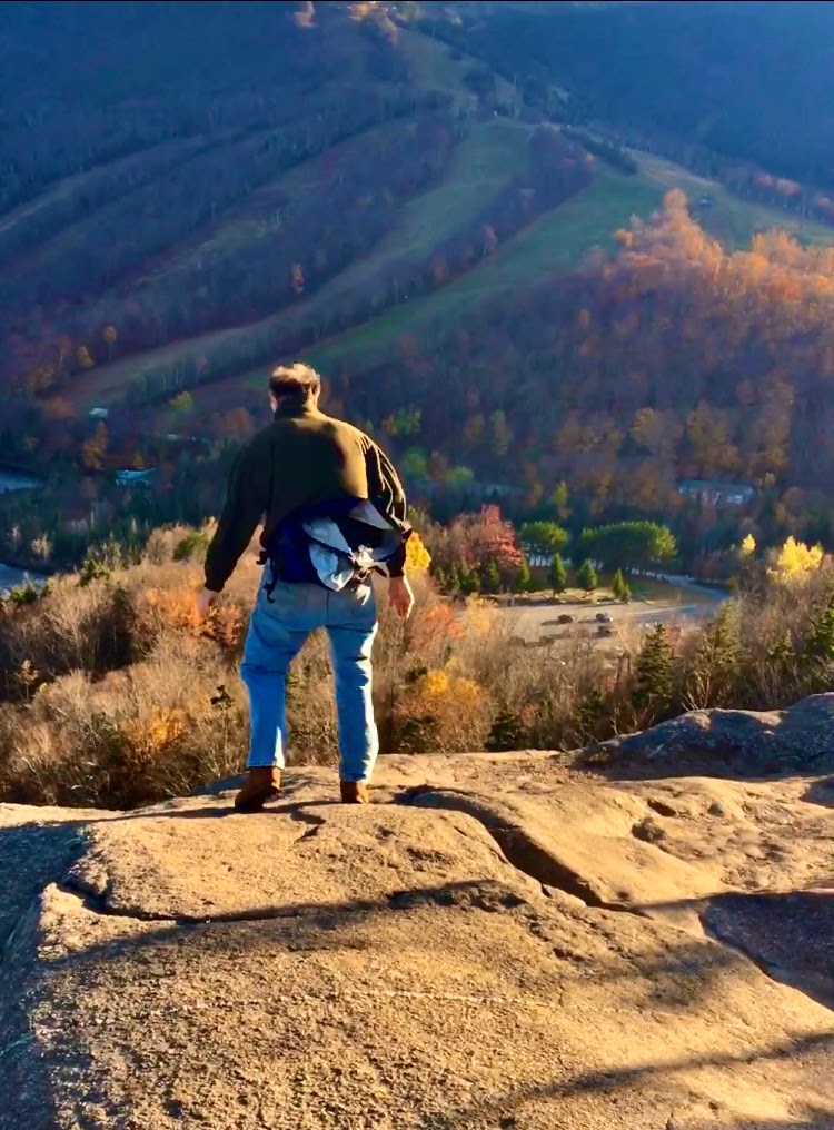
Trying to stay upright during the blasts of wind!, Photo Credit: Sarah Marsh 
My father and I at the Bald Mtn. Summit, Photo Credit: Sarah Marsh
We decided to stay up on Bald Mtn. until the sunset, but the wait until the sunset was spent hunched over between a boulder and baby summit trees that sheltered us from the wind. Once the sun made its way past the hills in the distance we were gifted with a beautiful view of the sunset colors and golden hue blanketing Cannon Mtn., Echo Lake, and the fall foliage.

Panorama of the Cannon Mtn. and Echo Lake area and sunset, Photo Credit: Karan Marsh
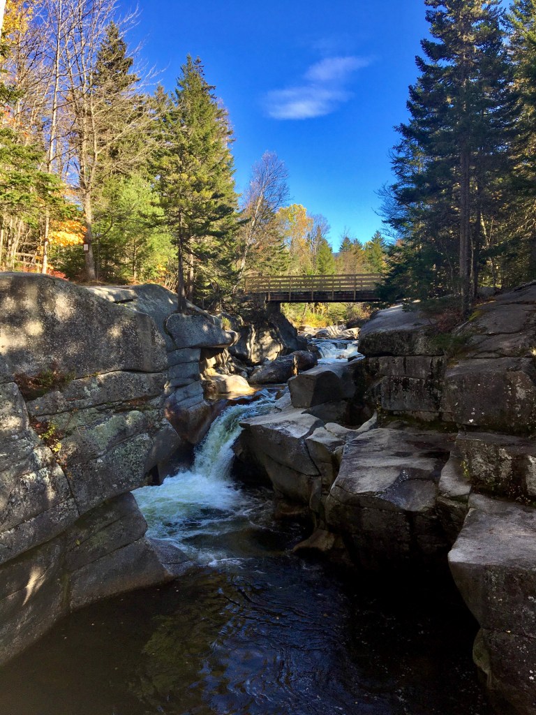
On Friday we hunkered down in the VOLM condo and watched the rain pour on the mountains and the fog puffs appear and disintegrate in the mountain notches. After helping my mother with a few computer issues I decided to venture out into the rain to take a walk down to the large bridge over the Pemigewasset River that heads over to the Loon Mountain Resort. I have to say, I think the dull light and rain makes the fall foliage especailly vibrant in color and I enjoyed my brisk and cool walk over the bridge and under the bridge on to the rocks in the river and back up to the condo.
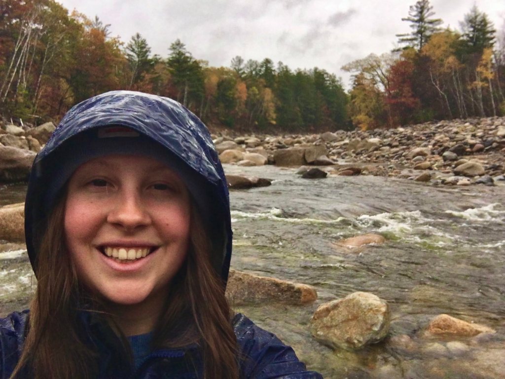
Selfie on the Pemi,
Photo Credit: Sarah Marsh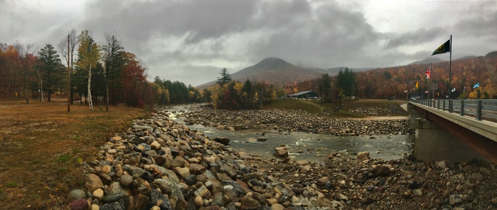
Loon Mountain Flag Bridge,
Photo Credit: Sarah Marsh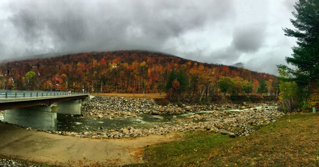
Loon Mountain Flag Bridge,
Photo Credit: Sarah Marsh
The next morning we awoke to snow on Loon Mountain! I was actually aware that this might happen because an old friend of mine, Nathan, had mentioned it on Facebook the previous night. After packing up all our things and checking out of the condo, my father and I made our way up Franconia Notch.

Morning snow on Loon Mountain, Photo Credit: Sarah Marsh
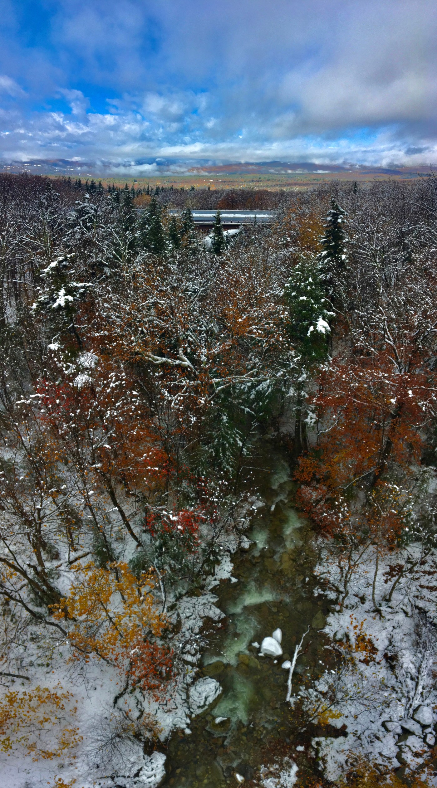
We first stopped at The Basin and checked out the river flow and did a quick walk up to the Kinsman Falls. We then made our way up and over to go down 302 through Crawford Notch, but not with out first stopping at the Governor Gallen Memorial Bridge that crosses the Lafayette Brook and looks out over the town of Franconia. The parking lot was COVERED in snow, and so was Cannon mountain a little ways back. I have to say, in my opinion, there aren’t many more beautiful things than colorful fall foliage covered in snow and a river passing underneath with mountains and hills in the background.

Favorite photo of this year!, Photo Credit: Sarah Marsh
Towards the bottom of Crawford Notch we stopped at a locals access to the Saco River through Crawford Notch and stood by the river for a few moments. We then completed our loop by taking Bear Notch Road that connects the town of Bartlett to the middle of the Kanc (Highway 112) and drove out through Lincoln and continued down I-93 all the way back home to Groton, MA.
Saco River running through Crawford Notch, Photo Credit: Sarah Marsh
Thank you for reading about my week of adventure in the White Mountains! Look out for next weeks post because I have some BIG news to share. So stay tuned! I have a question for you all though, if I made videos of my hikes or adventure trips, would you watch them and subscribe to a YouTube channel? Comment below with a response!
Have a wonderful rest of your week. Stay Safe.
Mahalo and Kia Ora!

Leave a comment